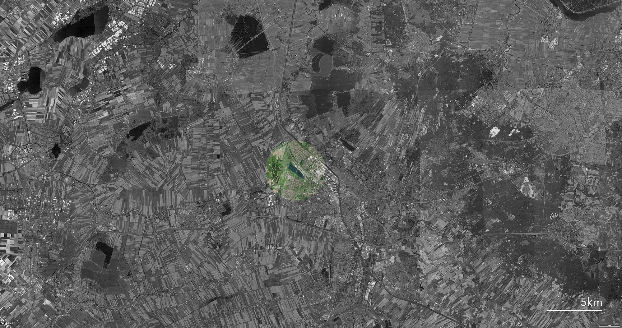
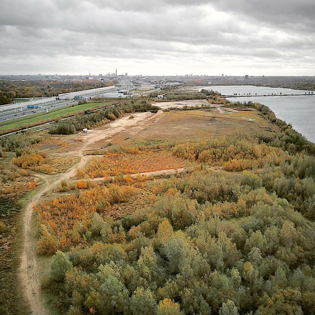
103
Haarijnseplas
Arboreal Survey
Utrecht, The Netherlands 2018
![]()
The survey consisted of a systematic photo flight over the area. Delivered products covered an orthophoto with 5cm ground resolution, a Digital Elevation Model with a resolution of 10cm and the position and height of the major tree species.
Arboreal Survey
Utrecht, The Netherlands 2018
The survey consisted of a systematic photo flight over the area. Delivered products covered an orthophoto with 5cm ground resolution, a Digital Elevation Model with a resolution of 10cm and the position and height of the major tree species.
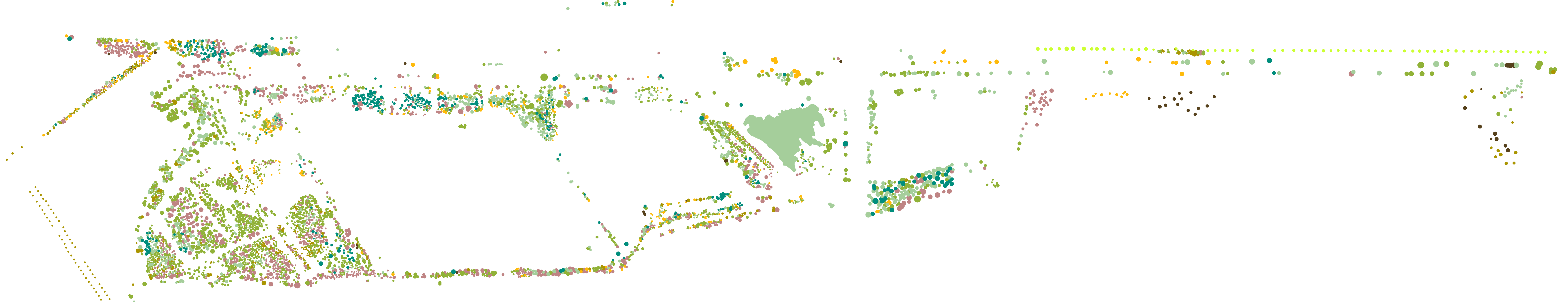
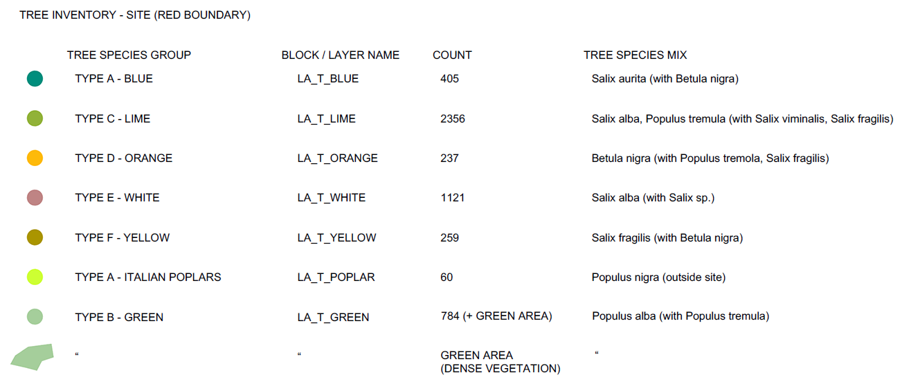
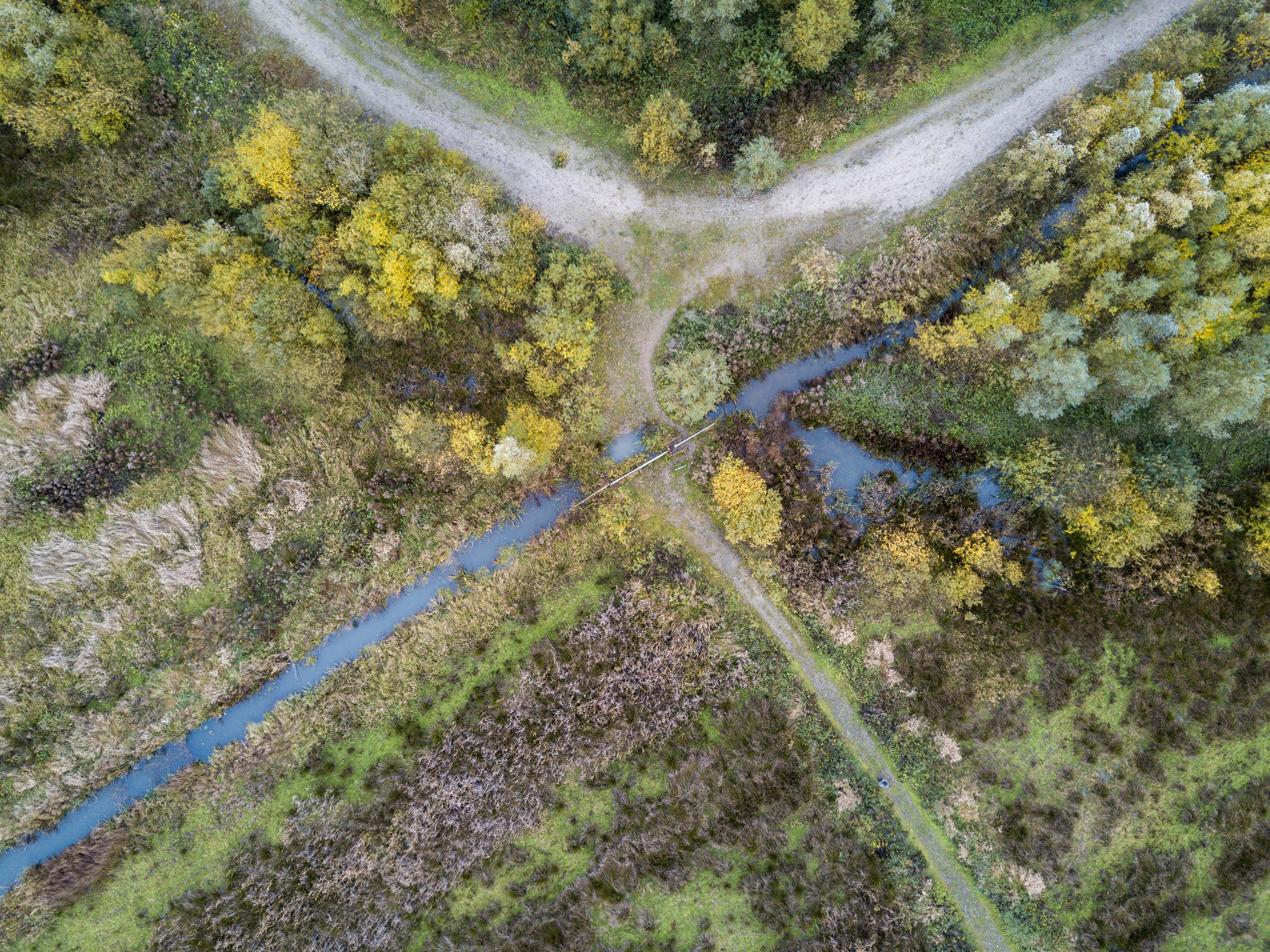
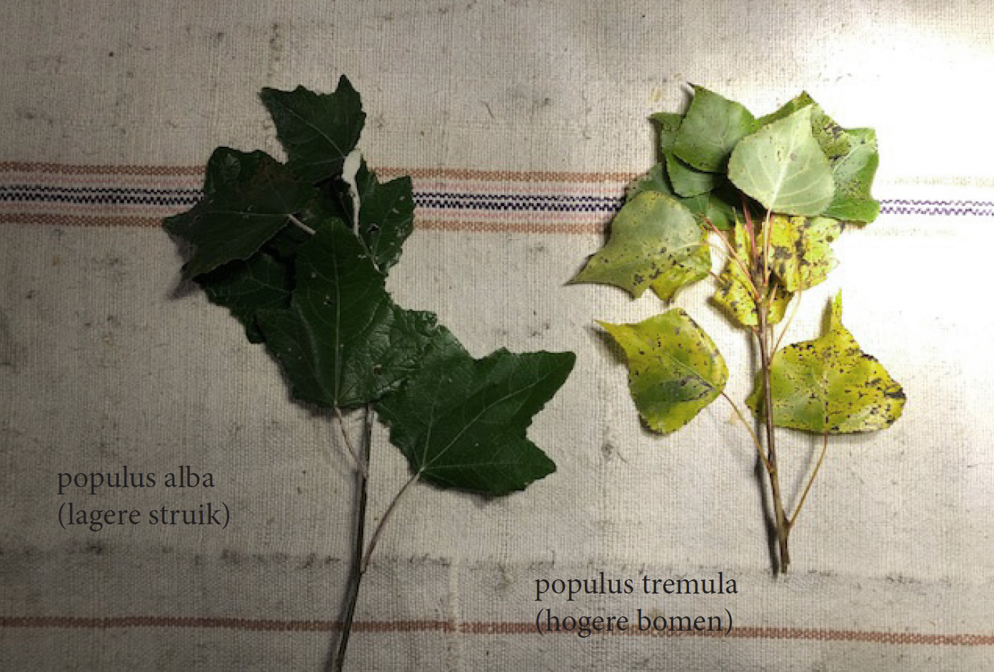
During the survey, trees were documented and samples collected in order to accurately determine the different species during the data analysis.


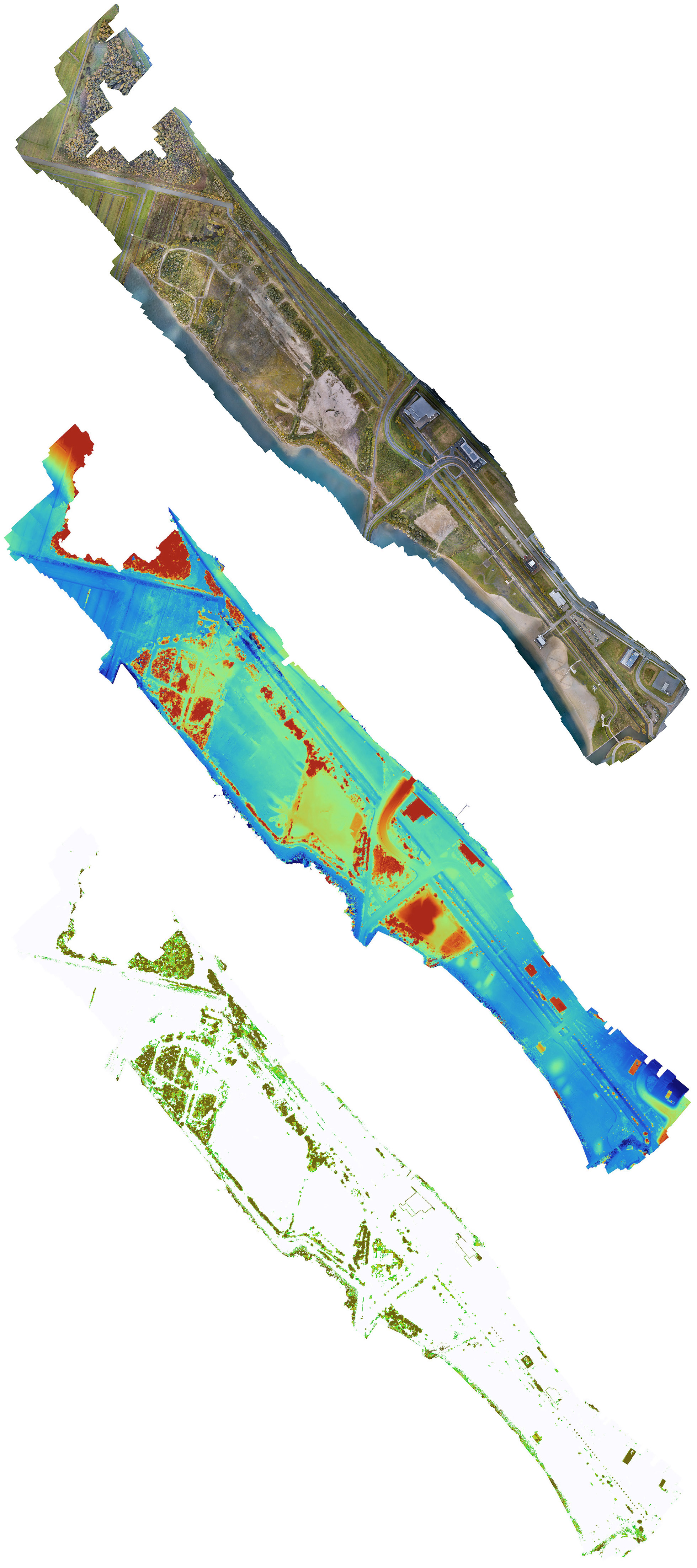
Ortho-mosaic, DOM and vegetation survey techniques in application
![]()


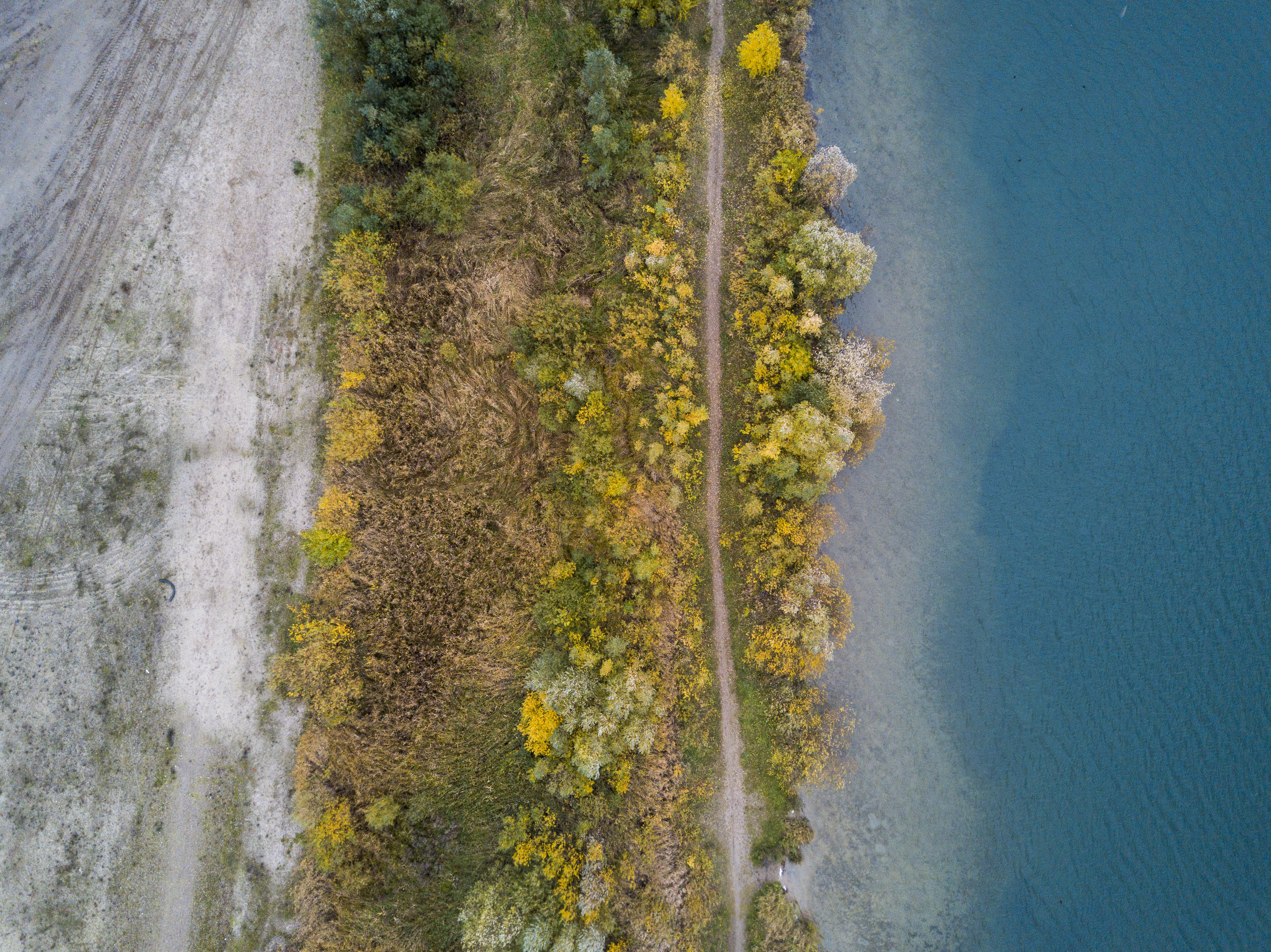
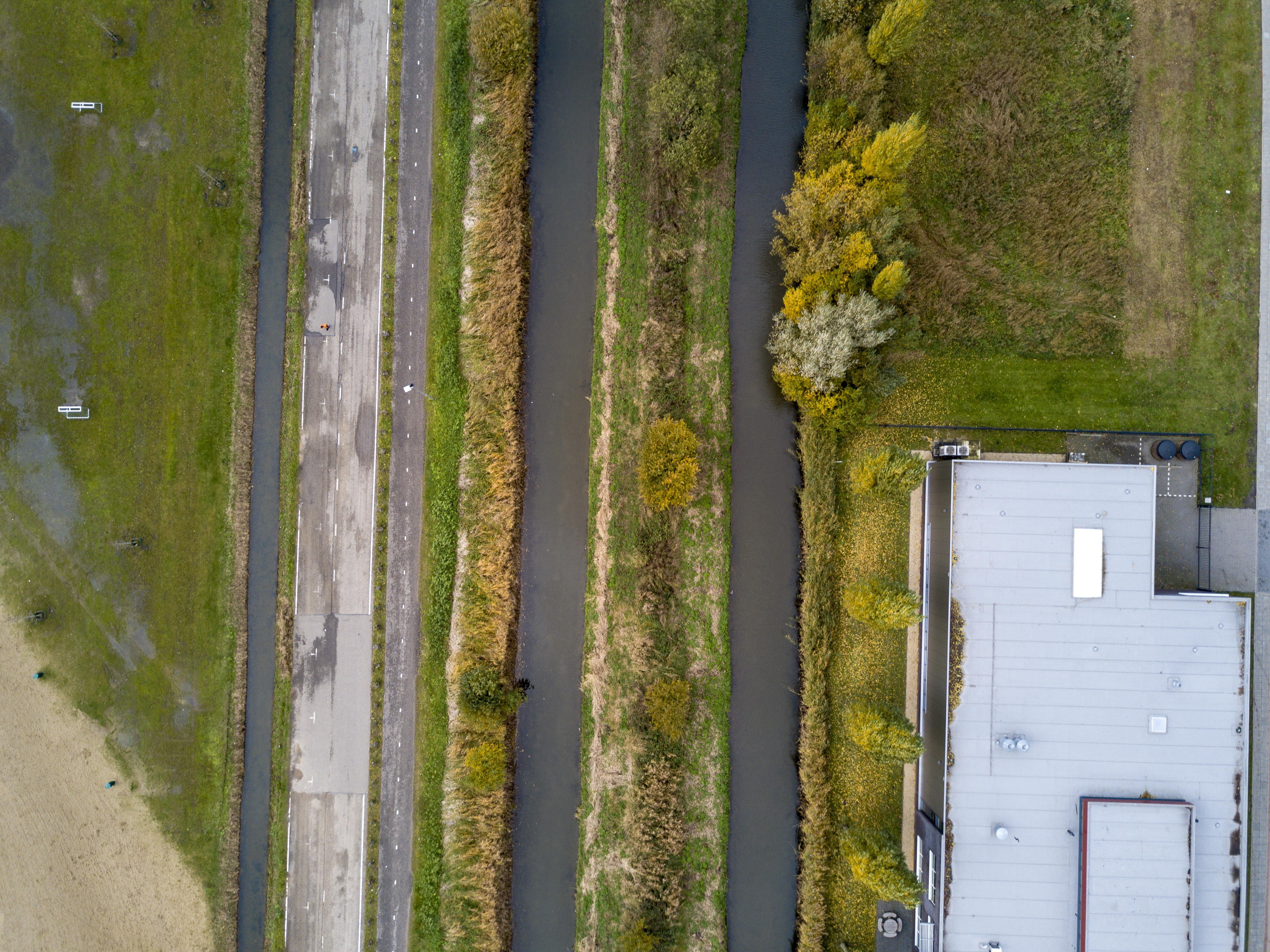
This arboreal survey was commissioned by the Municipality of Utrecht City, the Netherlands.